Map of the Historic Maumee River and Its Tributaries
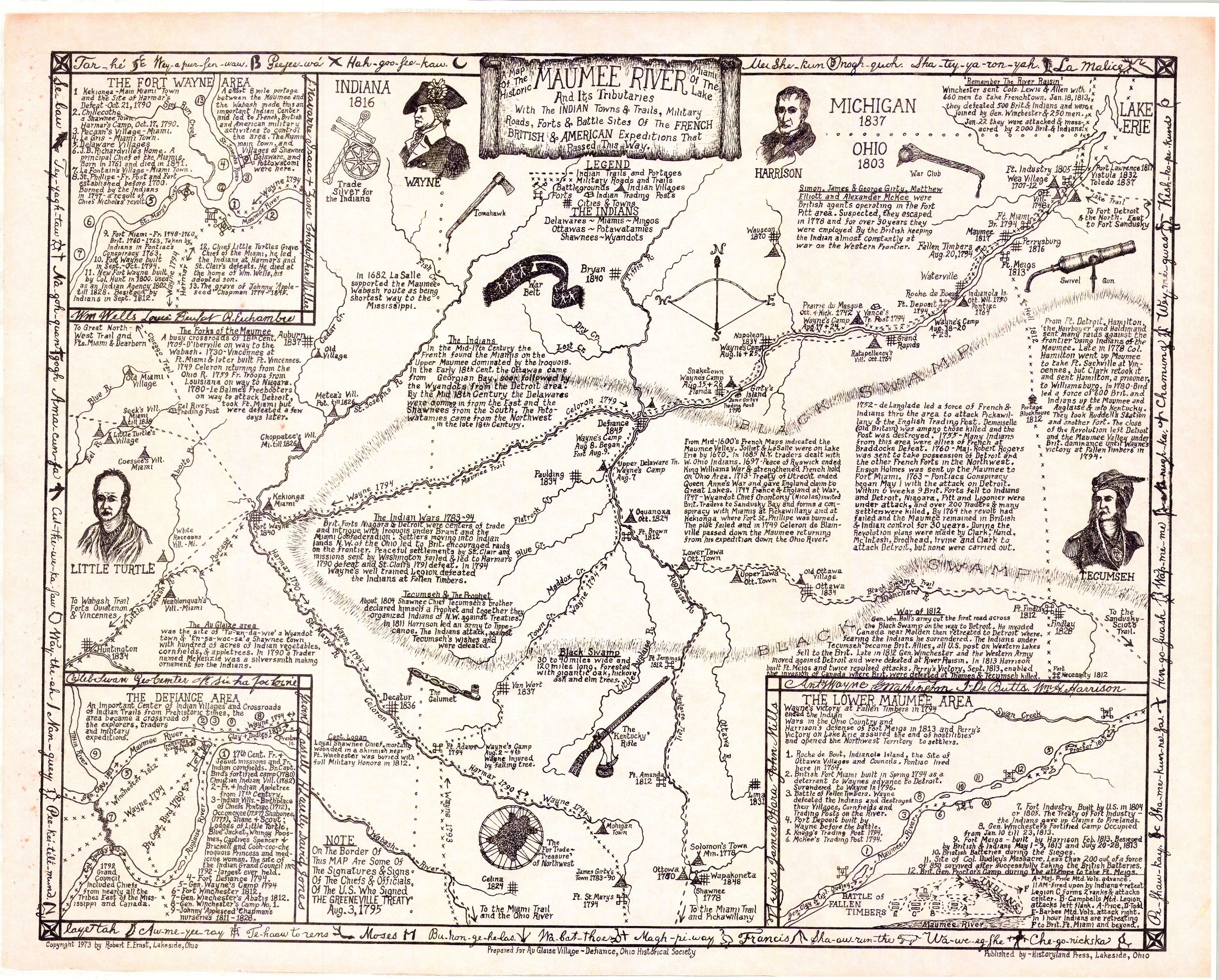
A detailed reference map compiled in 1973 by Robert E. Ernst, covering the Maumee River and its tributaries across present-day Ohio, Indiana, and Michigan. It plots Indian towns and trails (Delaware, Miami, Ottawa, Potawatomi, Shawnee, and Wyandot), military roads, forts, and the battle sites of French, British, and American expeditions that passed through the region — including “Mad” Anthony Wayne’s 1794 campaign, the Battle of Fallen Timbers, and War of 1812 engagements.
The map directly labels Paulding (founded 1834 on the map’s dating) and the Black Swamp, and includes inset detail maps of the Fort Wayne, Defiance, and Lower Maumee areas. It’s a useful visual companion to this archive’s transcriptions of the 1882 Historical Hand-Atlas and the county engineer’s history overview, both of which cover the same pre-settlement military and Native American history in text form.
Note on dates: the map’s legend states some of its signatures/marks come from the Greenville Treaty (Aug. 3, 1795) chiefs and officials.